Hiking on the Katzenbuckel – The Path of Crystals
Since I have been drawn to the Odenwald a lot in the last few weeks, it was only a matter of time before I would take a hike on the Katzenbuckel (Katzenbuckel means cat’s hump in German). The Katzenbuckel is the highest mountain in the Odenwald and several hiking trails lead around it or over its summit. There is for example the Katzensteig, a 12-kilometer trail, but today I will first introduce you to the Path of the Crystals. This hike is a quick one but no less beautiful.
The Katzenbuckel
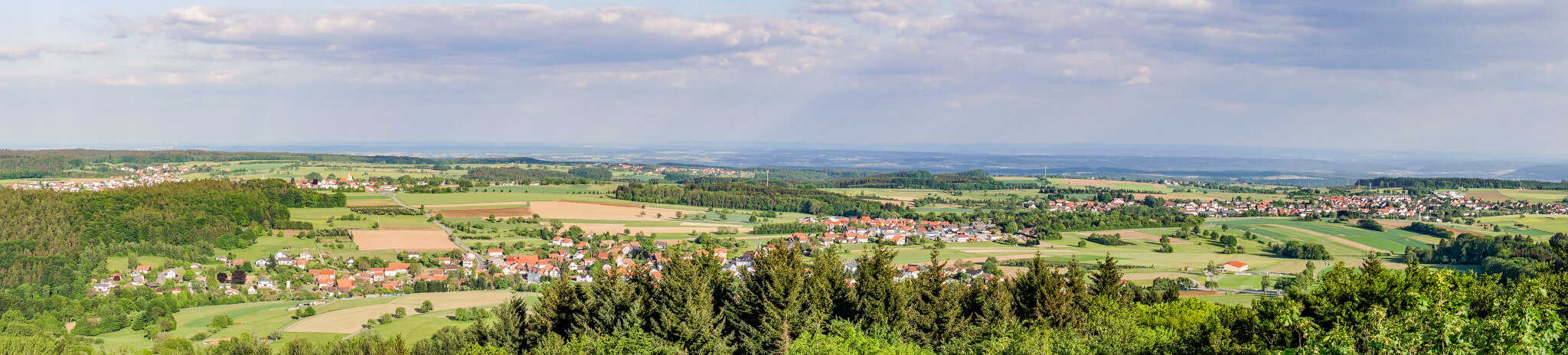
The highest mountain in the Odenwald – the Katzenbuckel – is located in the border triangle between Hesse, Baden-Württemberg, and Bavaria and is actually an extinct volcano. Its vent has a diameter of almost 1000 meters. At 626 meters, it is enthroned in the red sandstone plateau of the Odenwald and stands out from its surroundings due to its easily recognizable shape. It is located near Waldkatzenbach in the far south of the Odenwald. On the summit, there is a tower of the same name, from where you have an amazing view.

How Has The Katzenbuckel Been Created?
About 60 million years ago, the Katzenbuckel erupted, which was probably very explosive due to a steam explosion when the magma came into contact with the groundwater. This is indicated by tuffs and small volcanic bombs. Today neither collapse funnels nor craters are visible. So the assumption is based purely on geological findings.
Since the end of the 19th century, volcanic rock has been mined in two quarries: Gaffstein and Michelsberg. In the 1920s, however, only one quarry was still visible on the maps: The Gaffstein had fallen victim to mining. In 1970 a blasting led to the fact that the work on the second quarry was also stopped: Groundwater had seeped into the Michelsberg Quarry and the Katzenbuckelsee (the lake of the Katzenbuckel) was created.
Where Does The Name Katzenbuckel Come From?
There are various explanations, but none of them is verified.
-
- The most obvious explanation is that the shape of the mountain resembles the back of a cat.
- Another assumption is that the name is etymologically derived from the Chatti – a Germanic tribe that lived in this area. They once had their main settlement area in northern and central Hesse and their name lives on in the neighboring state of Hesse, which is only three kilometers away from the Katzenbuckel.
The Path of Crystals
For your hike on the nature trail, you should choose a day with good weather if possible, as there is a lookout tower on the top of the Katzenbuckel which gives you an excellent all-round view. But only in good weather. Here are a few facts in brief:
Distance
Duration
1 Hour
Difference in Altitude
144 Meters
Highest Point
626 Meters
The Starting Point: Turmschenke / Villa Katzenbuckel
Until January 1st of 2020, the restaurant at the Katzenbuckel was in the hands of the Geier family. During the 65 years, the Turmschenke became a popular place in the Odenwald. Since May 18th of 2020, it has been reopened under new management and with a new name: The Villa Katzenbuckel awaits guests with Odenwald specialties. The restaurant is also a lounge, bar and hotel.
There is a parking lot from where you can plunge into the short adventure. Two large info boards mark the beginning of the Path of Crystals.


The Katzenbuckelsee (Lake Katzenbuckel)
After a short hike, you get to the Katzenbuckelsee. As described above in the section on the formation of the Katzenbuckel, it was created by a blasting in the former quarry. Groundwater had entered the quarry, after which it was abandoned. You can get a glimpse of the lake through the trees, but unfortunately, you can’t get close enough to take a good photo from the Path of Crystals. The trees are also very dense. If you want to get to the lake, you can try it by leaving the path.
As you go halfway around the lake, you will pass several info boards that give information about the formation of the Katzenbuckel and the minerals. In this way, the hike gains an informative aspect and also becomes a journey into the history of the earth. Of course, you can decide how much background information you want to have.

The Viewpoint Katzenbuckel
When you leave the lake behind you, it won’t be long before you can see the old tower between the trees. But do not confuse it with the ski jump of the Eberbach Ski Guild, founded in 1949. The ski jump is closed and may not be entered.


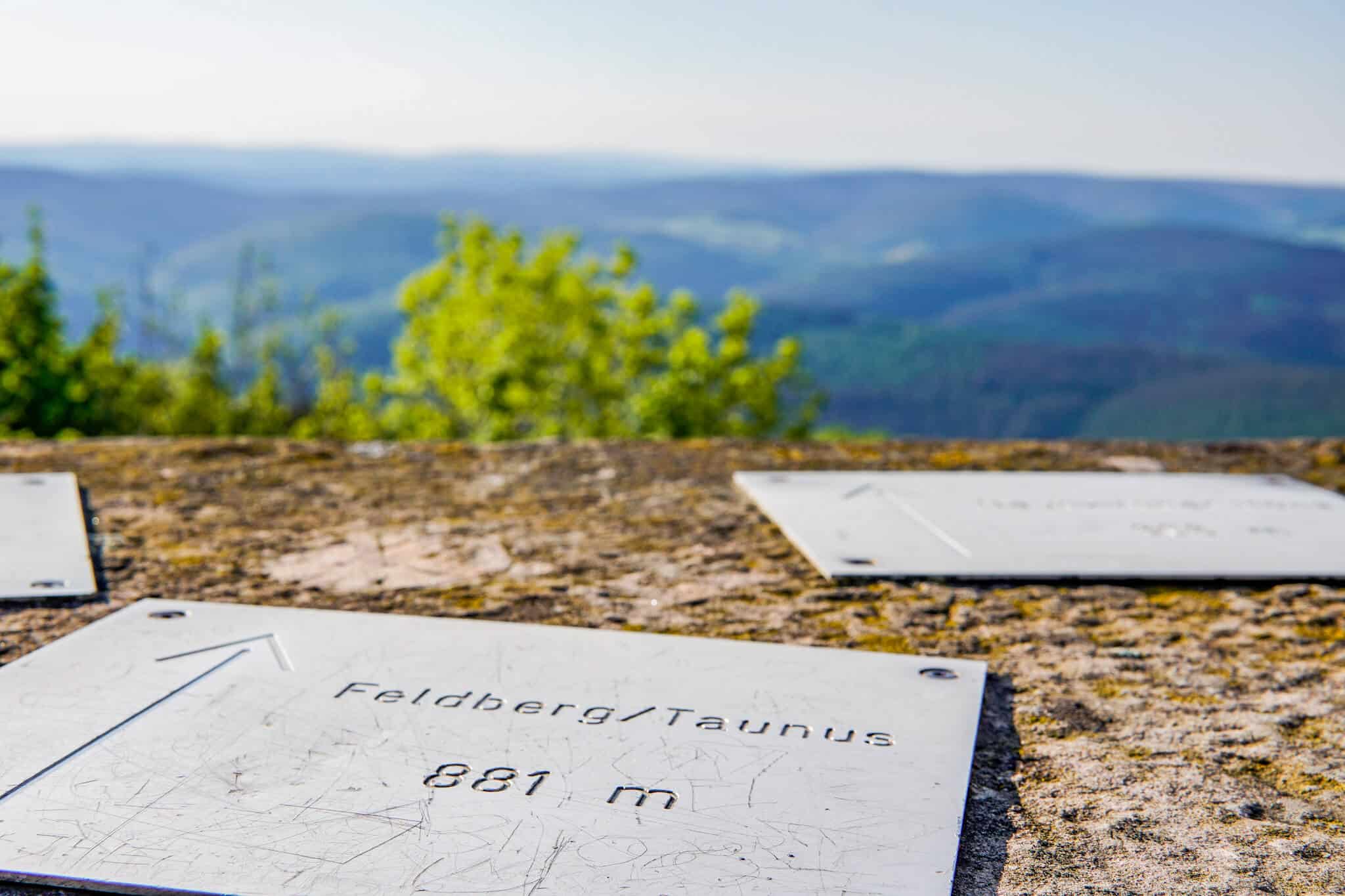
The observation tower, on the other hand, is an 18-meter-high stone tower that was built in 1820. The round tower is made of sandstone – just like this part of the Odenwald. Once you reach the top, you have an excellent view of the Taunus, the Spessart, and even the Rhön.
From the observation tower, it is only a stone’s throw back to Villa Katzenbuckel. On the way there you have a great view of Waldkatzenbach and can enjoy the moment on benches at the edge of the forest.


In the Villa Katzenbuckel, you can stop by if you wish and let the day end quietly.
Ideas For Nearby Activities
The Horse Farm Pan Perdu
Close to the Katzenbuckel, there is a horse farm called Hof Pan Perdu. I recently spent a whole weekend here (a separate post will follow!) and I can highly recommend it to you if you love animals as much as I do and would like to explore the Odenwald from horseback. The four-legged friends are elegant and gentle and will certainly give you unique experiences if you are open to them.
The Katzenbuckel Spa
Alternatively, you can also give your body a break: In the local spa Katzenbuckeltherme there are several swimming pools, a relaxation area, and a sauna are waiting for you. A visit here can be perfectly combined with a hike. But make sure that it is open! While I am writing these lines, it is still closed because of Corona.
Hiking in the Region
About hiking in the Odenwald, I have already written an own article. I have also written a blog post about the Felsenmeer and the Gorge of Margaret.
If you like hiking and want to explore the surrounding regions, I can recommend having a look at the Palatinate Forest, the Spessart, or the Taunus. Blog posts will follow for these regions. So far, I can only refer you to my blog post about Staufen in the Taunus outside the Odenwald.
City Trips in the Region
If you want to make a city trip in this part of Germany, I recommend the following cities:
- Aschaffenburg: Aschaffenburg is nicknamed the gate to the Spessart. Besides the (partly very photogenic) sights like the Aschaffenburg castle, which the town itself has to offer, you can also reach the forest quickly from here and can let off steam on many hiking trails.
- Heidelberg: Heidelberg is located directly at the Neckar and offers a picturesque backdrop with the river, the old town and the castle on the mountain. Here you will also find the ideal mixture of town and countryside.
- Lohr am Main: Lohr am Main was first mentioned in a document in 1295 and is generally known as Snow White town. Although this is not documented, it is quite possible, since the Brothers Grimm lived in Hanau and passed through the Spessart on their way to Bremen.
- Mannheim: The square city is worth a visit at any time. Whether inside or outside, there is always something to do or experience here.
- Michelstadt: The historical old town with the famous town hall and the half-timbered houses is simply enchanting. My tip: Take a photo tour at sunrise when you have the cobblestone streets all to yourself! Near Michelstadt there are a lot of hiking trails so that you won’t get bored.
- Miltenberg: The small town in Lower Franconia is located between Odenwald and Spessart and is a real gem. The old town is picturesque and even the starting point of several hiking trails. The Mildenburg and the museum of the city of Miltenberg offer the culturally interested among us the opportunity to quench their thirst for knowledge.
My Gear
On my tours, I am mainly on the road with clothes and equipment from Decathlon. My hiking boots for example are waterproof half-height hiking boots. In general, if you are a regular hiker or outdoor enthusiast, I recommend that you buy some appropriate clothing and shoes. In the worst case, normal sneakers will do, as long as they give you a good grip and you can handle them if they get dirty. On hikes like the one in the Margarethen Gorge, this can happen faster than you can look.

I would also recommend protection for your phone. I got a nice scratch when I was hiking in Margaret Gorge. And that’s even though my phone didn’t fall off or bump into anything. At least not consciously. Therefore, I have now an outdoor case.
By the way, I take my pictures with a Sony Alpha 6500*. I usually switch between my two favorite lenses: a 10-18mm wide-angle lens* and a 30mm fixed focal length*. In case you’ve ever wondered how I take pictures of myself even though I’m often on the road alone: I have a Rollei tripod*.
My Final Thoughts
I love being out in nature, but for me, it doesn’t have to be a day hike every time I go out. Therefore I liked the Path of Crystals on the Katzenbuckel very much. The hike is not long but with the tower and the view, it is still a lot of fun. Also, like this you have more time to enjoy the view, the restaurant, the horse farm, or the spa…
Have you ever been on the Katzenbuckel?

Did you like this blog post?
Share it in your social networks!
Newsletter
Subscribe to my newsletter so I can keep you posted about my life of travels and as a digital nomad! You will never miss a new blog post, a new ebook or where my next adventure is going to bring us. Because it’s never going to be boring!

GERMANY
THE FELSENMEER

GERMANY
PHOTO SPOTS IN FRANKFURT

GERMANY
THE GORGE OF MARGARET